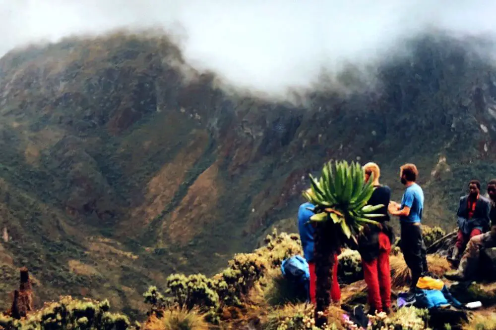
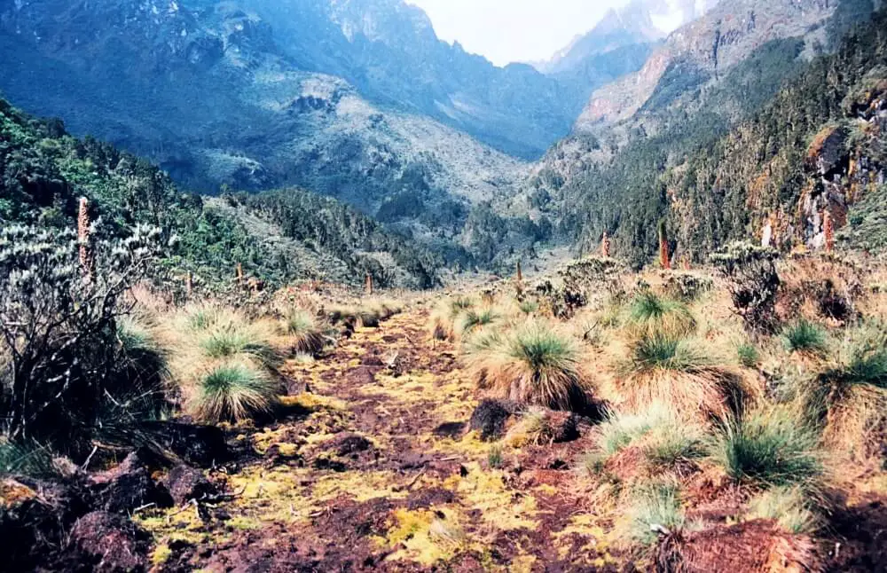
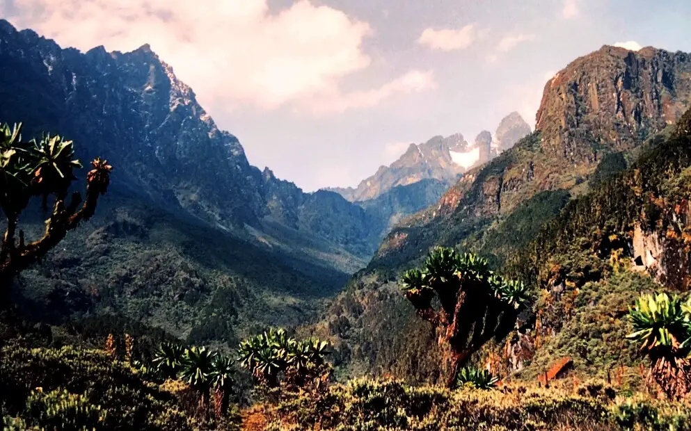
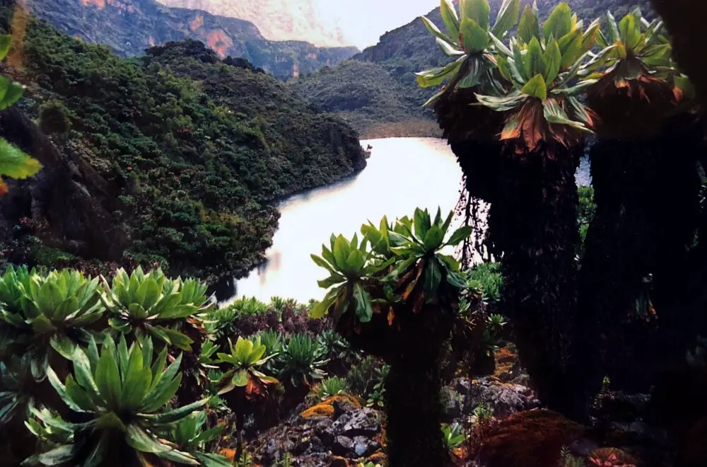
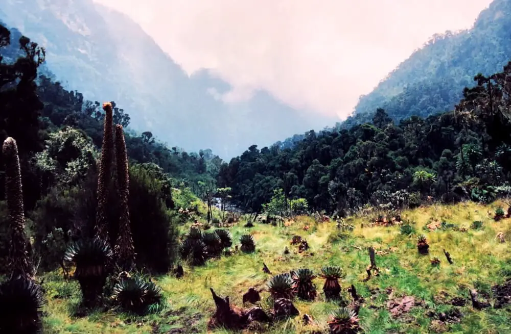
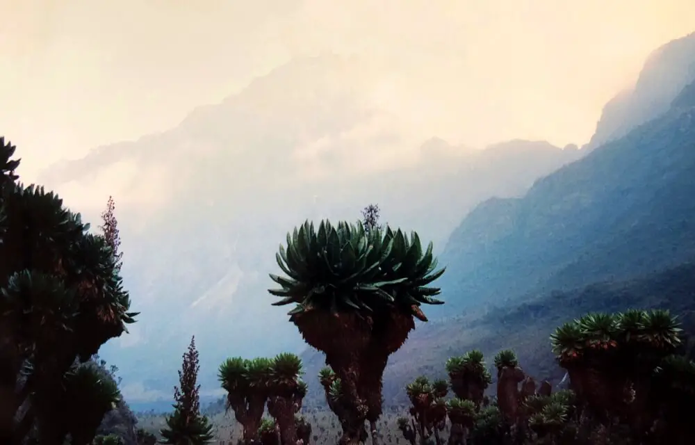
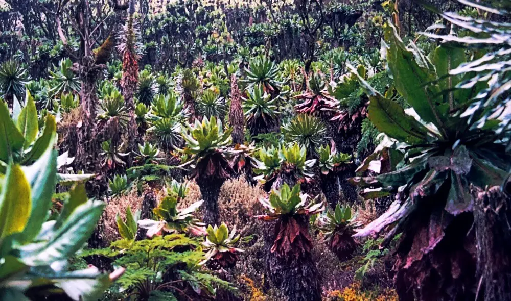
I feel like I am walking through an alien landscape. Plants that look like enormous cabbages mounted on the tops of tall stalks tower overhead. Giant lobelias – usually only 3-36 inches (10-90 cm) tall – make me feel small.
Mist clings to these plants, adding to the atmosphere. A dramatic mountain peak rises far above us in the distance. A small lake forms the bottom of the valley below. I have never seen anything like this place before.
No time right now to read about the trekking Rwenzori Mountains National Park (the Mountains of the Moon trek)? Pin it and save it for later:
Please note that some of the links below may be affiliate links. If you make a purchase through these links, I earn a small commission at no additional cost to you. Read my Disclaimer for more information.
Subscribe to monthly updates with tips for planning, travel inspiration and trip ideas and get instant access to the free PDF of this
Guide to Trekking Rwenzori Mountains
Mountains of the Moon trek details
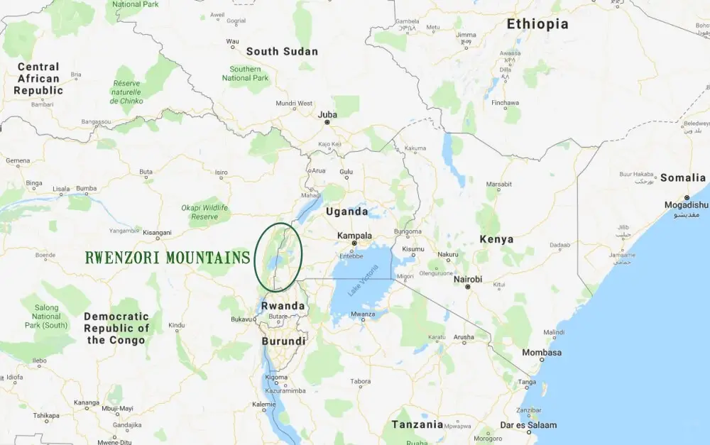
The Rwenzori Mountains (also called “The Mountains of the Moon”) straddle the equator between Uganda and the Democratic Republic of Congo (DRC; formerly Zaire).
I was travelling through Africa and when I first heard about the Mountains of the Moon, I was intrigued and wanted to learn more.
Facts about the Rwenzori Mountains
Almost 2,500 years ago, in the fourth century B.C., Ptolemy marked “Lunae Montes” (The Mountains of the Moon) on his map of Africa in their correct location.
However, Stanley is commonly identified as the first white person to confirm their existence. He actually first saw them on 1876, but it wasn’t until 1888 that he confirmed their existence. He first thought he was looking at a cloud, but then realized it was actually a snow-covered mountain.
These are the largest range of mountains in Africa and contain the third highest peak in Africa. The highest peaks of the range were first climbed in 1906. They were declared a United Nations World Heritage Site in 1994.
Where are the Rwenzori Mountains?
On the Ugandan side is Rwenzori Mountains National Park and on the Democratic Republic of Congo (DRC – formerly Zaire) side is Virunga National Park. Uganda is in central eastern Africa.
Ugandan trekking is the best option because Rwenzori National Park is the safest and easiest to access.
This area of the world has seen a lot of civil war in recent years, so it is essential to check current safety conditions before going there.
Numbers are limited each year (which helps preserve the delicate environment) and all trips to the Rwenzori are accompanied by local guides and porters. This not only makes it easier (because you don’t have to carry everything), but also employs local people, which helps give them a vested interest in preserving the area.
Rwenzori trekking is not easy because of the conditions, but hiking is a great way to see and experience this amazing planet, so it is well worth the effort. I did the hike in Uganda, and this is safer, since the DRC has a pretty unstable political situation. ALWAYS CHECK FOR UGANDA ALSO and do not go if it is unsafe!
The main massifs in the Rwenzori Mountains
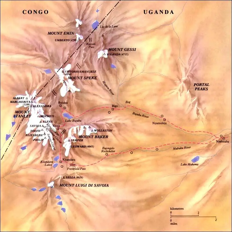
There are many peaks in the Rwenzori range, but the six main massifs in the central park area are:
- Mt. Gessi (15,470 feet/ 4,715 m) All of the glaciers have melted from this once ice-covered massif
- Mt. Emin (15, 741 feet/ 4,798 m) There are no longer glaciers on this massif.
- Mt. Speke (16,043 feet/ 4,890 m) There used to be huge glaciers on the north side of Mt. Speke, but they have all melted. The Speke Glacier on the south side still exists, albeit much smaller. There are also several smaller glaciers near Ensonga Peak.
- Mt. Stanley (16,762 feet/ 5,109 m) There are still many glaciers, including the Stanley Plateau which, at over one kilometer long, is the largest glacier in the Rwenzori Mountains.
- Mt. Luigi Di Savoia (15, 328 feet/ 4,627 m) This was the first to lose its glacial ice.
- Mount Baker (15,889 feet/ 4,843 m) There are no glaciers on the way to the peak.
Hiking routes in Rwenzori National Park
There are two main hiking routes in Rwenzori National Park:
- The Central Circuit route. This is the oldest and most-established route and the one I took and describe. There are several tour operators here (see below). The route begins in Ibanda. There are some variations on the route possible, but the route is typically 7-9 days. This is the route I took.
- The Kilembe route. This was opened in 2009 and only one tour operator does trips here – Rwenzori Trekking Services. This begins in Kilembe in the south-east, joining the central circuit at the Kitandar Lakes. This route is 6-9 days.
Rwenzori trekking services
The easiest way to do the hike in the Rwenzori Mountains is to use a company to help you organize it.
Note that each trek can be a little different from the one I describe below, depending on how far you go each day, but the overall experience is similar.
Here are two good options for packages that both include pickup and drop off at Entebbe Airport in Kampala (click on the links to book)
- 8-day hike with pickup and drop off at Entebbe Airport. Click here to see the details, dates, prices and to book.
- 7-day hike PLUS safari to Queen Elizabeth National Park and Lake Mburo National Park with pickup and drop off at Entebbe Airport. Click here to see the details, dates, prices and to book.
Companies for the main Central Circuit include:
For the southern Kilembe route, there is one operator:
Hiking tips and equipment you will need
This a tough hike, but because you will have porters and a guide, it can be done by (reasonably fit) novice hikers. However, there are some basic things you should know. Be sure to read:
- Guide for Beginner Hikers
- Hiking Etiquette
- Best Hiking Gear for Beginners *** very important*** make sure you have the right gear or you will be miserable!
- Essential Day Hike Packing List. This is a multi-day hike, but the porters will carry most of your gear, so you will just need to the things on this list to carry with you each day.
- Make sure you have really good hiking boots or shoes. Check out my guide to the Best Hiking Shoes/ Boots for reviews and recommendations.
- You will disconnected for a week or more, so if you need to recharge your camera or phone (for the camera), you will need a solar charger. I recommend the Goal Zero Nomad 10. Buy it in Amazon here or read more information on my guide to the Best Solar Panels here.
Best time to visit the Rwenzori Mountains
Hiking is possible all year, but the rainy seasons are March – May and November, so these are the low season. The best time of year to hike the Rwenzori Mountains is July to September and January to February.
How to get to the Rwenzori Mountains
Uganda’s capital city, Kampala, is the main gateway to the Rwenzori Mountains. The airport, Entebbe Airport has frequent connections with Nairobi in Kenya.
From Kampala, there are two major routes to the mountain, both taking about a day to reach Ibanda:
- northern route via Fort Portal, then south to Ibanda. The roads range from excellent to rough dirt tracks.
- southern route via Kasese. The roads are generally good, paves surfaces. This is the route I took. It crosses the equator twice.
Booking with a tour operator that arranges transfers to/ from the airport is definitely the easiest option!
Where to stay in the Rwenzori Mountains
Most accommodation is not flash, but is adequate.
Where to Stay in Kampala/ Entebbe Airport
- A nice option near Entebbe airport is the Airport Guesthouse.
- Kampala – check out different options here
Where to stay in Ibanda/ Kasese
Some options include:
- Rwenzori Homestay
- NBK Star Hotel (1.1 km from Ibanda)
- Ruboni Community Camp
In addition to camping, they have furnished rooms with hot showers, mosquito nets and electricity (hydroelectric power). There are good views of the Rwenzori Mountains from the restaurant and some rooms.
There are three rooms, a campsite, a bar and a restaurant that serves traditional Ugandan food. It is located in Mihunga village and is run by the community.
Where to Stay along the Rwenzori Mountains hiking route
There is a good system of huts along the main circuit of the Rwenzori. These include:
- John Matte Hut (11,090 feet/ 3,380 meters)
- Bujuku Hut (13,025 feet/ 3,977 meters)
- Elena Hut (14,895 feet/ 4,540 meters)
- Kitandara Lake Hut (13,212 feet/ 4,027 meters)
- Guy Yeoman Hut (10,695 feet/ 3,260 meters)
- Nyabitaba hut (8,694 feet/ 2,650 meters)
Subscribe to monthly updates with tips for planning, travel inspiration and trip ideas and get instant access to the free PDF of this
Guide to Trekking Rwenzori Mountains
Description of the Uganda safaris to the Rwenzori Mountains
Day 1 of Rwenzori Mountains Hike
Hike time: 4-5 hours officially (It took me 3 including lunch)
Stayed: Nyabitaba hut [8,700 feet/ 2,650 m]
We drove from Kasese, where we had seen loads of marabou storks scavenging in the rubbish that was piled around town. It was a 12.5-mile (20-kilometer) drive to the base camp at Ibanda.
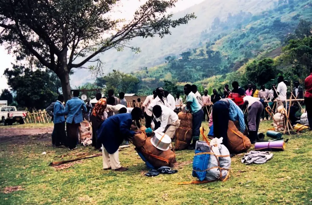
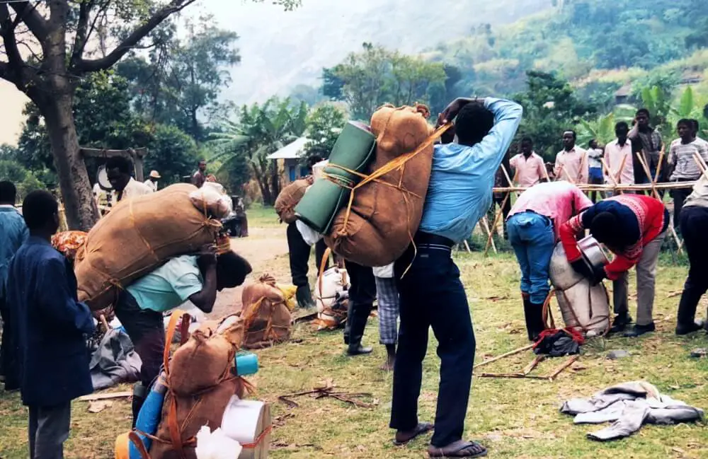
After watching a (pretty awful) 30-minute introductory video about the mountains, we met our guide and porters. Each porter carries a maximum 22 kilograms, so the weight of everything needed to be distributed accurately. Each porter got a blanket and a jacket, food and cigarettes plus a small wage per day. Their food was weighed and distributed first, and then our food and our personal gear last.
Everything was loaded into burlap/ hessian sacks and each porter tied straps of banana bark around their sack to make a head strap with which to carry each sack. We set off at 10:50am.
The walk started along the road to the Nyakalengija gate and was steady until our lunch break around 12:30pm. After the break, the going got steep, as we started to follow the Mubuku River. I went at my own pace, but my muscles were aching, as I was pretty unfit. The walk was through beautiful rainforest and the scenery and views were superb.
I arrived at the Nyabitaba hut around 1:45pm and had the rest of the afternoon to relax (though it showered for a while in the late afternoon.)
Day 2 of Rwenzori Mountains Hike
Hike time: 7 hours officially (It took me 4.5 including lunch)
Stayed: John Matte Hut [11,100 feet / 3,380 m]
I set out at 8:30am after a horrible breakfast of sago pudding. The conditions were probably the best these mountains have to offer; it was dry all day. Even the bogs weren’t the horrendous quagmires I had expected, although they were nonetheless extremely muddy. Since “Rwenzoris” means “Rain Maker” or “The Great Leaf in Which the Clouds are Boiled”, I was pretty lucky that it is as dry as it was.
This morning started with a rapid descent first thing to cross the Mubuku River. Then it consisted mainly of clambering up and down gullies over rocks, through a bamboo forest, always going higher. It was hard going and my muscles hurt a little as they got an unaccustomed workout. I was glad to stop for lunch.
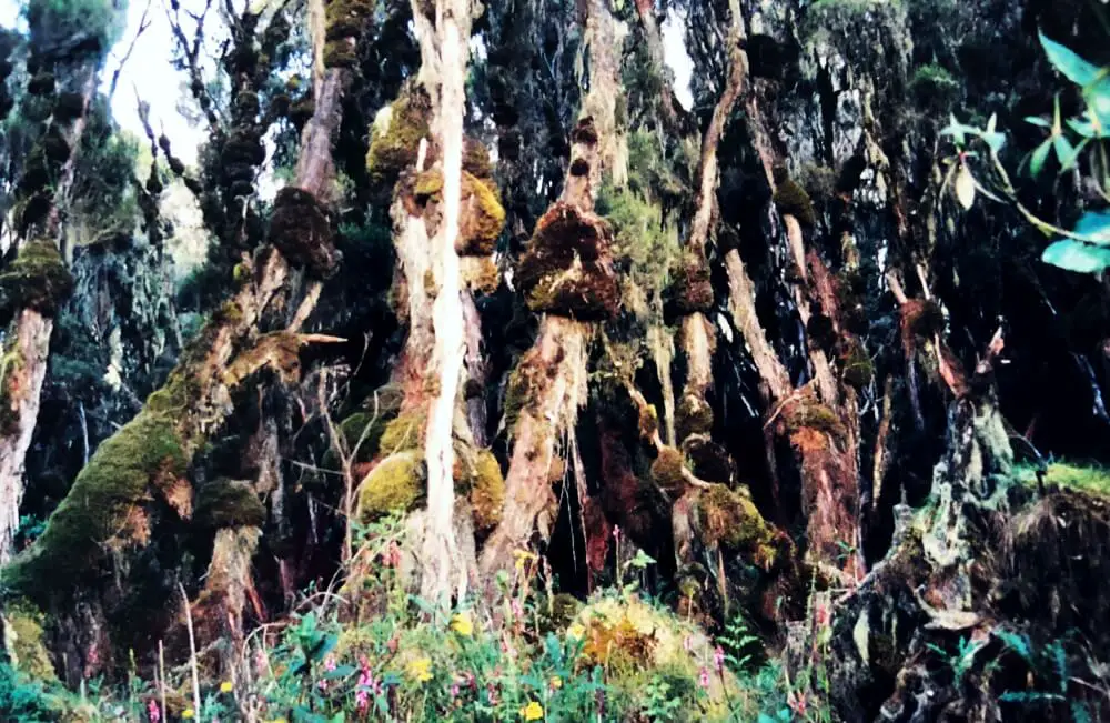
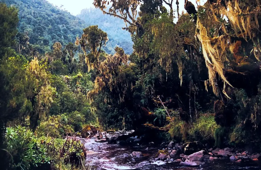
Gradually the scenery changed and the hour’s walk after lunch was amazing. We were out of the rainforest and into an eerie forest of trees strung with hanging Irish moss and covered in huge clumps of thick clumps of moss with ferns and giant lobelia. There was total silence except for the nearby river. It was amazing.
We passed through a bog, jumping from tussock to tussock and glad to see bits of boardwalks in a few places, even though they weren’t very frequent and those that were there, were not in great condition. Then more of the mossy forest before reaching the hut.
I was quite drained after the physical activity, though it felt good to exercise.
Day 3 of Rwenzori Mountains Hike
Hike time: 5 hours officially (It took me a slow 4 hours)
Stayed: Bujuku Hut [13,100 feet/ 4,000m]
Amazing scenery
The walk today was just amazing. The vegetation was incredible, with much of it unique to these mountains. There are giant lobelia 10 feet high and huge trees alien with large cabbage-like plants on top. Mist hangs from the trees. It is another world.
Mud
And a muddy one – unfortunately, most of these incredible plants grow in boggy conditions. We passed through three bogs, starting with the Lower Bigo Bog. From there, we made a side trip up the Mugusu Valley to Moon Lake (Lac de la Lune), thought to be Ptolomy’s source for the Nile. It is beautiful, nestled in the bottom of the valley, surrounded by more spectacular vegetation.
Back on the main trail, there was some pretty muddy uphill climbing and clambering over tree roots as I go through Upper Bigo Bog and past Lake Bujuku.
As I jumped from one tussock of grass to another across the bogs, I didn’t always make it, and fell in the mud a couple of times up to the top of my boots and once up to my thighs. That was a little scary and I was caked in mud by the end of the day, but mostly it was fun – and the scenery so overwhelmingly amazing that the mud seemed almost incidental.
The hut was a tiny corrugated iron room with a tiny wood-fueled heater in the middle. It was very basic, but cozy.
Tomorrow we will be going to the peak, so we spent the evening sorting out crampons and ice axes from the supplies left at the hut for the ascents.
Some struggled
Not all of my companions had as good a day as I did. One of my friends, Vicky, was sick and took 6 hours, staying with the guide and retching all day.
Two others, Mark and James, sped ahead of the guide and accidentally took a wrong path, arriving to the hut at 4:00pm just before the guide and head porter were about to head off to find them.
Day 4 of Rwenzori Mountains Hike
Hike time: 3.5 hours round trip
Stayed: Bujuku Hut [13,100 feet/ 4,000m]
We got up just before 6:00am and left the hut to ascend Mount Speke about 6:30am. We scrambled up a steep rock face (at about a 60-degree angle). It is a little scary at times as we shuffled around the vertical cliffs along a ledge that is only a few inches wide for a foothold.
Another sheer rock face has little more than a horizontal crack in the rock where we can put our feet as we cling to the rock and shuffle along to a wider path. I don’t look down.
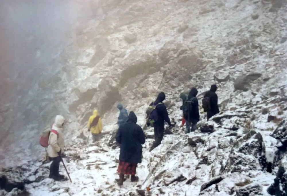
Unfortunately, it started to snow. We kept on going, but eventually, only about an hour away from the peak, faced with steep, smooth rock covered with small drifts of snow and with a blizzard beginning to blow, and with the guide saying the next hour would be dangerous in these conditions, we turned back.
Going back down was sometimes slippery going – it would have been extremely dangerous if there had been more snow. We got back about 10:00am disappointed but certain we’d made the right decision.
Day 5 of Rwenzori Mountains Hike
Hike time: 5 hours officially (It took me 3.5 hours)
Stayed: Kitandara Lake Hut [13,200 feet/ 4,025 m]
The first part of the hike was tough, especially since it was raining and slightly snowing this morning, but then it became easier and was a pretty short day. I arrived at Kitandra Hut about 12:15 and had the rest of the day to relax. Some of my companions set out earlier than I did and went up to the peak of Alexandria.
Day 6 of Rwenzori Mountains Hike
Hike time: 10 hours – over 2 days – officially (It took me a very determined 8 hours + 1 hour rest)
Stayed: Nyabitaba Hut/ base camp [8,700 feet/ 2,650 m] Note: It’s most common to do this in two days, staying at the Guy Yeoman Hut in the Mubuku River Valley at 10,700 feet /3,260 meters.
This day was hell. We decided to do 2 days’ walk in one day and this was a really bad decision. The entire 8 hours were spent wading through mud. The first few hours was in a thick cloud and I could barely see. Then I banged my head on the pointy end of a log and had a thumping headache.
To make things worse, I hardly ate all day, so I felt faint and nauseous. I spent the last hour expecting to see around the next corner. Instead, there was yet another bog. When I finally arrived, I was white, felt ill and was so exhausted I could barely lift my feet.
The scenery was amazing still, but I barely noticed, as I was consumed by my own misery.
Some of my friends pressed on and made it to the bottom and on to Kasese, but there was no way I could have done it. I should have done what most people do and spent the night in the Guy Yeoman hut.
Day 7 of Rwenzori Mountains Hike
Hike time: 2.5 hours
Stayed: Kasese (where I had a shower!!!)
The final day was only 2.5 hours, thank God.
I had huge blisters on my feet and aching muscles. I weighed myself at the bottom and I had lost 8 pounds/ 4 kg in one week.
The verdict: Rwenzori Mountains Trekking
Hiking the Rwenzori Mountains was one of the highlights of my trip to Africa, without a doubt. The scenery and the vegetation is out of this world.
The name “Mountains of the Moon” is totally appropriate – I have never been anywhere that looks like them and was awe-struck. However, the last two days were tough – I would NOT recommend trying to do two days’ worth of hiking in one day. Do not underestimate the mud!
Practical Tips: Visiting Uganda
Other things to do in Uganda
You have flown all the way to Uganda, which is probably far from home. You’ve done a trek that very few people in the world have done and seen one of the most incredible landscapes on the planet.
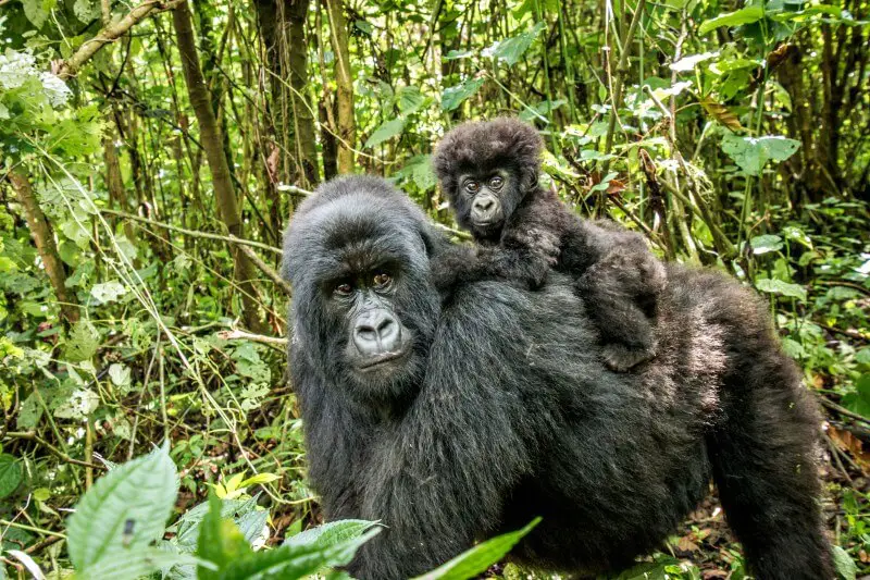
However, Uganda is most famous for something else – the mountain gorillas (think “Gorillas in the Mist”. I did a mountain gorilla trek in Uganda and it was mind blowingly amazing. Read this Guide to Gorilla Safaris for more details.
There are also hikes to see chimpanzees in the wild in Uganda. Plus big game in nearby game parks. Uganda really does have it all!
Here is a 12-day trip to can add on to your Rwenzoris trek that goes to the chimpanzees, game parks and mountain gorillas. See the details and book here.
What to Eat in Uganda
While you’re in Uganda, I recommend trying the local food. It’s a great way to immerse yourself in the culture – and it’s delicious. Discover traditional Ugandan foods (and etiquette) before you go, so you know what to look out for when you’re there.
What is the currency in Uganda?
The currency in Uganda is the Ugandan shilling (UGX). Check out the current exchange rate here.
Visa requirements for Uganda
There is a very good chance that you will need a visa for Uganda. For visa requirements, check out your home country’s official government visa websites:
For citizens of other countries, use this helpful website (though it’s best to always check with the embassy as well).
Make sure you give yourself plenty of time to get the visa before you travel.
Also, I recommend you have at least 6 months left on your passport after your trip. This is a requirement for some countries, and this can change, so it is always best to play it safe.
Planning and packing for Uganda
When planning a trip, I always use a combination of blogs and guidebooks. I like the Lonely Planet and they have for East Africa, that includes other countries. Buy the East Africa Lonely Planet here.
If you are just going to Uganda (and that is enough for a two- or three-week vacation), then there is a guidebook just for Uganda. Buy the Bradt Uganda Guide Book here.
You will probably be able to get by with English, but if you want to try your hand at a local language, pick up the Lonely Planet Swahili phrase book here.
A trip to Africa is no small undertaking. Take the stress out of planning with my Trip Planner, which breaks the while planning and preparation stages down one thing at a time.
When you are ready for your trip, check out my Essential Packing List.
Safety in Uganda
I had no problems traveling in Uganda, but it does pay to be careful. Always check the current situation to make sure there is no political unrest. The US government has a website that issues travel advisories.
The US government also has health advisories – check what vaccinations you need. I recommend checking at least 6 months before you travel. Some vaccines require several shots over a period of time, so you want to make sure you have time.
I’m not trying to scare you, but you may also have people try to scam you. Read about the most common travel scams so you can recognize them when they start to happen and you can avoid falling prey to them.
Also check out my post on 13 things NOT to do when traveling (and learn from my mistakes).
Finally, even when you take all precautions, things CAN happen. So you should definitely get travel insurance.
Additional consideration: Travel Insurance
You need travel insurance whenever you travel and should definitely not head to Africa without it. For more information on exactly what to look for, read my guide to buying travel insurance.
A great insurance option is Travelex. It has coverage for all you’ll need. You can compare Travel Insurance plans here.
Why do I like Travelex? It’s been around for over 25 years. Unlike many insurances, it covers a range of adventure sports and activities and has several plans and optional upgrades, so it is easy to get coverage for your exact trip.
You can get a quote right now:
Subscribe to monthly updates with tips for planning, travel inspiration and trip ideas and get instant access to the free PDF of this
Guide to Trekking Rwenzori Mountains
Happy trekking!
Do you have any stories of Uganda ? I’d love to hear them. Comment below.
If you liked this post, please share the love and Pin it to your Hikes and Africa boards!
For more hikes, read:
- Laguna Torre hike, Patagonia, Argentina
- French Valley hike, Torres del Paine NP, Patagonia, Chile
- Bright Angel Trail, Grand Canyon NP, USA
- Hike from Portofino to San Fruttuoso, Italy
- Devil’s Garden Trail, Arches NP, USA
- The Narrows, Zion NP, USA
- Best hikes, Bryce Canyon NP, USA
- The Congress Trail, Sequoia NP, USA
- Cascade Canyon, Grand Teton NP, USA
- Best hikes, Acadia NP, USA
About the author

James Ian has traveled to 83 countries and all 7 continents. He is passionate about experiential travel, i.e. meaningful travel that actively engages with the environment and culture. He helps people have similar experiences that involve active participation in activities and festivals; engaging with the local food and handicrafts through lessons and food tours; and interacting positively with environment by hiking, riding, rowing, diving and low/no impact animal encounters.
Travel Collecting is a participant in the Amazon Services.com LLC Associates Program, an affiliate advertising program designed to provide a means for sites to earn advertising fees by advertising and linking to amazon.com. Amazon and the Amazon logo are trademarks of Amazon.com, Inc. or its affiliates.

